Since we didn't want to deal with the super long timeframe of shuttling cars back and forth we rode this out'n'back from the base to the top and then dropped back down. It took 3 hours to climb (with numerous camera breaks) and 44 minutes to descend - half of it in a good, pouring rain. The descent was fantastic and the views were super scenic.
The other GORCers rode AngelFire and had the time of their lives. I was torn and wanted to do both but Winsor, again, was a trail I'd been wanting to ride since last year. I'll post up some AngelFire photos when I get their camera images.
Oh, you might want to ask Mike why wearing a helmet is generally a good idea. Never saw anything quite like it...
 The trail begins by climbing between residential properties for the first mile. If you didn't keep pushing you'd swear this trail was anything but beautiful or epic.
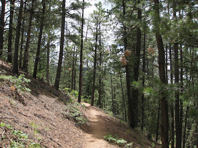
 We broke out into this meadow a three miles up the trail and entered the Ponderosa Pine section. The trail base is damp and similar in feel to the Pacific Northwest (weird), enters the Pines, then Aspen and finally, high elevation foliage.
 Many parts of Winsor are in mint condition. Large sections, however, are turning into a downhill course with huge ruts, gaping wide singletrack and general trail cargnage. Since the trail follows the Tesuque drainage, it's tough for it to even come close to IMBA's recommended trail gradients.
 The climb was steady and doable until it got stupid steep near the top. The Garmin 800 loaded with a ton of area trail courses was invaluable with the numerous intersections, lack of signage and forest maps not featuring all the trails available.
 The view from the top of Winsor near the Santa Fe Ski and Recreation area. The scenery stretched over 70 miles. Classic mountain bike awesome. Classic.

No comments:
Post a Comment